![](/images/other/stat-length.png)
![Excursión Senderismo Les Premiers-Sapins - chasnans - Photo](https://media.geolcdn.com/t/1900/400/18238f28-18ef-4f29-9286-6fb5e9688ff0.jpg&format=pjpeg&maxdim=2)
chasnans
eltonnermou
Usuario
![Longitud](/images/other/stat-length.png)
![Altitud máxima](https://static1.geolcdn.com/siteimages/upload/files/1508320355ic_sort_altitude_max_24dp.png)
![Desnivel positivo](https://static1.geolcdn.com/siteimages/upload/files/1508320355ic_sort_den_pos_24dp.png)
![Km-Effort](/images/other/stat-length.png)
![Altitud mínima](https://static1.geolcdn.com/siteimages/upload/files/1508320355ic_sort_altitude_min_24dp.png)
![Desnivel negativo](https://static1.geolcdn.com/siteimages/upload/files/1508320355ic_sort_den_neg_24dp.png)
![Boucle](https://static1.geolcdn.com/siteimages/upload/files/16400158638029165_repeat_loop_refresh_sync_direction_icon.png)
![Senderismo](https://static1.geolcdn.com/sitytour/trail-icons/101.png)
1h35
Dificultad : Muy fácil
![Escanee este código QR para abrir la excursión en la aplicación SityTrail](https://capi.geolives.com/qq0zvz2zws4bq2lad0pu/sitytour/trails/2823026/qr.png?size=200)
Aplicación GPS de excursión GRATIS
A propósito
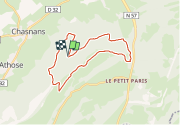
Ruta Senderismo de 7,9 km a descubrir en Borgoña-Franco Condado, Doubs, Les Premiers-Sapins. Esta ruta ha sido propuesta por eltonnermou.
Descripción
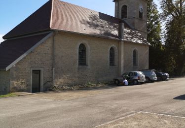
parking : baraque de chasse de Chasnans
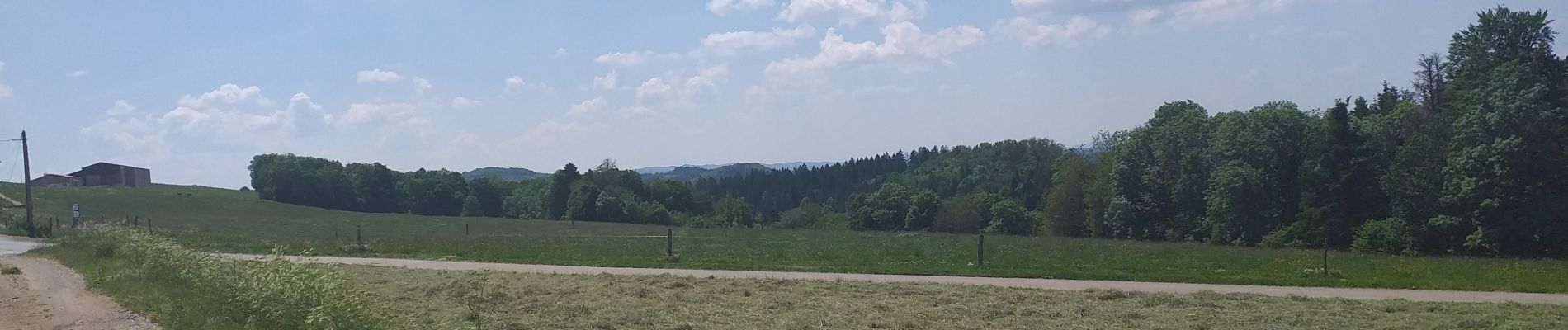
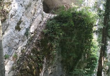
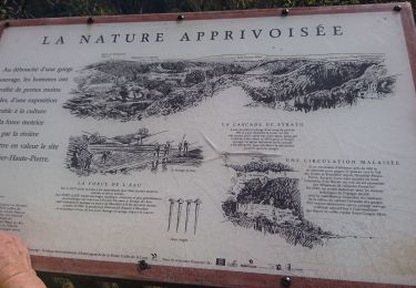
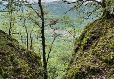
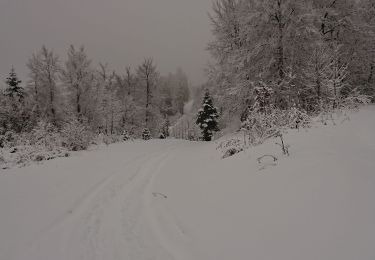
A travers bois et de belles prairies, flore protégée et variée ; des points de vue qui réchauffent les yeux ; un dénivelé qui ne peut faire peur, malgré le petit coup de cul entre 2,6 et 3 km. Nous traversons le domaine des chevreuils, à vous de vous laissez surprendre ....
Localización
Comentarios
Excursiones cerca
![Excursión Senderismo Mouthier-Haute-Pierre - Roche de Hautepierre (881 m) - Photo](https://media.geolcdn.com/t/375/260/ext.jpg?maxdim=2&url=https%3A%2F%2Fservices.sitytrail.com%2FGeolivesWS%2FDownloadMedia.ashx%3FTrailID%3D108779%26Media%3D1921_2.jpg)
![Senderismo Senderismo](https://static1.geolcdn.com/sitytour/trail-icons/101.png)
Senderismo
![](/images/other/stat-length.png)
![](https://static1.geolcdn.com/siteimages/upload/files/16400158638029165_repeat_loop_refresh_sync_direction_icon.png)
![Excursión A pie Mouthier-Haute-Pierre - Mouthier Haute Pierre - Photo](https://media.geolcdn.com/t/375/260/ext.jpg?maxdim=2&url=https%3A%2F%2Fstatic1.geolcdn.com%2Fsiteimages%2Fupload%2Ffiles%2F1545311037marcheuse_200dpi.jpg)
![A pie A pie](https://static1.geolcdn.com/sitytour/trail-icons/100.png)
A pie
![](/images/other/stat-length.png)
![](https://static1.geolcdn.com/siteimages/upload/files/16400158638029165_repeat_loop_refresh_sync_direction_icon.png)
![Excursión Senderismo Mouthier-Haute-Pierre - Gorges de Nouailles - Source de la Loue - Photo](https://media.geolcdn.com/t/375/260/1e011831-b1ba-44f5-a6f9-22ef92de1f5b.jpg&format=jpg&maxdim=2)
![Senderismo Senderismo](https://static1.geolcdn.com/sitytour/trail-icons/101.png)
Senderismo
![](/images/other/stat-length.png)
![](https://static1.geolcdn.com/siteimages/upload/files/16400158638029165_repeat_loop_refresh_sync_direction_icon.png)
![Excursión Senderismo Mouthier-Haute-Pierre - Mouthier Haute Pierre 21 juillet 2020 CAF - Photo](https://media.geolcdn.com/t/375/260/7d88d4ca-2235-4bcf-bd66-9a228b709c6e.jpg&format=jpg&maxdim=2)
![Senderismo Senderismo](https://static1.geolcdn.com/sitytour/trail-icons/101.png)
Senderismo
![](/images/other/stat-length.png)
![](https://static1.geolcdn.com/siteimages/upload/files/16400158638029165_repeat_loop_refresh_sync_direction_icon.png)
![Excursión Senderismo Mouthier-Haute-Pierre - source de la loue - Photo](https://media.geolcdn.com/t/375/260/187241ac-e2e9-4269-acf0-f4d48449c4c8.jpg&format=jpg&maxdim=2)
![Senderismo Senderismo](https://static1.geolcdn.com/sitytour/trail-icons/101.png)
Senderismo
![](/images/other/stat-length.png)
![](https://static1.geolcdn.com/siteimages/upload/files/16400158638029165_repeat_loop_refresh_sync_direction_icon.png)
![Excursión Senderismo Mouthier-Haute-Pierre - Mouthiers Haute Pierre / lods - Photo](https://media.geolcdn.com/t/375/260/6543d839-f281-4840-bccf-d2b29fcfc3ee.jpg&format=jpg&maxdim=2)
![Senderismo Senderismo](https://static1.geolcdn.com/sitytour/trail-icons/101.png)
Senderismo
![](/images/other/stat-length.png)
![](https://static1.geolcdn.com/siteimages/upload/files/16400158638029165_repeat_loop_refresh_sync_direction_icon.png)
![Excursión Raquetas de nieve Arc-sous-Cicon - ARC SOUS CICON](https://media.geolcdn.com/t/375/260/19b8c976-4c9f-4655-b7e5-28069cdc97a8.jpg&format=jpg&maxdim=2)
![Raquetas de nieve Raquetas de nieve](https://static1.geolcdn.com/sitytour/trail-icons/504.png)
Raquetas de nieve
![](/images/other/stat-length.png)
![](https://static1.geolcdn.com/siteimages/upload/files/16400158638029165_repeat_loop_refresh_sync_direction_icon.png)
![Excursión Senderismo Les Premiers-Sapins - hautepierre - Photo](https://media.geolcdn.com/t/375/260/187ae2f7-224f-4ceb-bfd7-d8a24c7bf434.jpg&format=jpg&maxdim=2)
![Senderismo Senderismo](https://static1.geolcdn.com/sitytour/trail-icons/101.png)
Senderismo
![](/images/other/stat-length.png)
![](https://static1.geolcdn.com/siteimages/upload/files/16400158638029165_repeat_loop_refresh_sync_direction_icon.png)
![Excursión Raquetas de nieve Les Premiers-Sapins - rando raquettes Nods - Photo](https://media.geolcdn.com/t/375/260/f2560bde-7dd4-49dd-a0d9-4fe4eccb3f0d.jpg&format=jpg&maxdim=2)
![Raquetas de nieve Raquetas de nieve](https://static1.geolcdn.com/sitytour/trail-icons/504.png)
Raquetas de nieve
![](/images/other/stat-length.png)
![](https://static1.geolcdn.com/siteimages/upload/files/16400158638029165_repeat_loop_refresh_sync_direction_icon.png)